Bates Street Trail
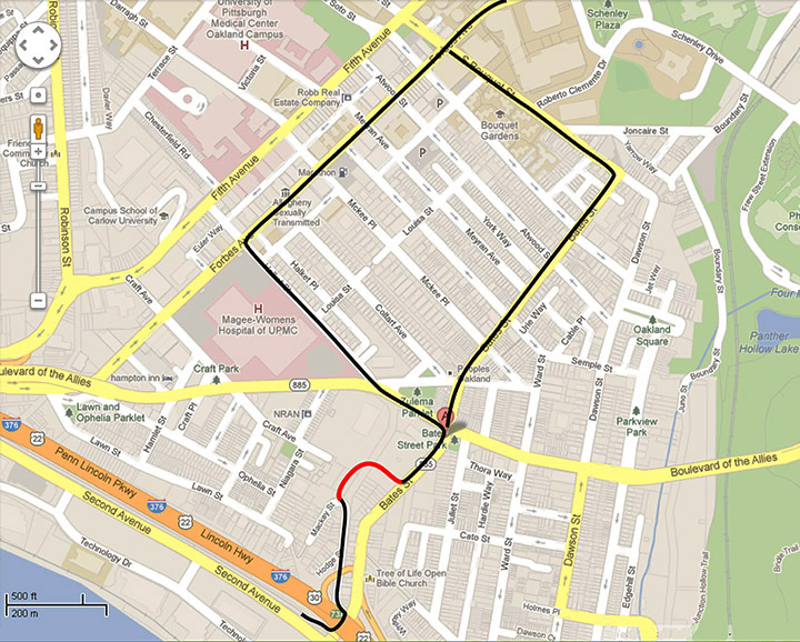
Bates Street serves as a major transportation link between the Route I-376 and Oakland, one of the highest density residential and commercial areas in Pittsburgh. Over 90,000 cars per day drive the quarter mile along Bates Street between the Boulevard of the Allies and the highway entrance and exit ramps. In addition to these few blocks being a major automotive connection, these same few blocks are also used as an essential bicycle connection between Oakland and the Three Rivers Heritage Trail.
As detailed on the Bates Street Page, riding a bicycle along this high traffic route is steep, narrow, and dangerous due to the high speed traffic on Bates Street. We propose that the sidewalk be doubled in width from the Boulevard of the Allies down about 600 feet along the hill. Below this point, we propose the use of a Hodge Street, a route adjacent to Bates Street, which takes pedestrians and cyclists through a wooded path and is more lightly traveled.
Bates Street Trail
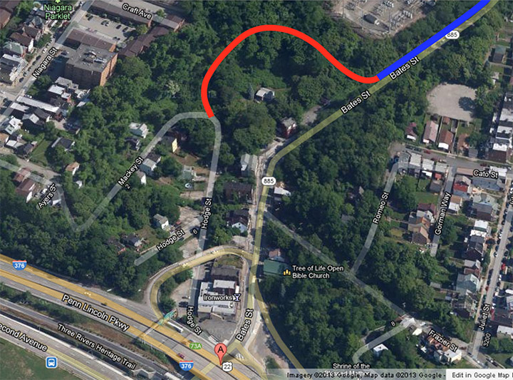
This proposed trail will connect Bates Street and Hodge Street through about 800 feet of wooded land. This trail travels along a route that had been used as a walking path for many decades prior to becoming blocked by fallen trees in the 1970s. Before this route became overgrown, it served as a transportation link for the residents of Oakcliffe traveling by foot up into Oakland Center. The sidewalk along Bates Street that we recommend being widened is indicated in BLUE. The trail from Bates Street to Hodge Street is indicated in RED.
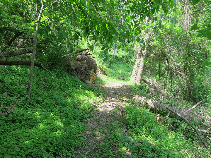
Entrance to the Trail
Starting in the spring of 2013, residents of Oakcliffe began clearing this overgrown trail from Bates Street to Mackey Street. In the center of this image is the entrance to the path as shown from Bates Street. The first section of this trail travels along the foot of the embankment of the Oakland electrical power substation, shown to the upper right of this image. Part of clearing this path involved removing decades of accumulated trash from the slope. To the left in this image are two shopping carts that were cleared from the path and returned to the local CVS pharmacy.

View Back Towards Bates Street
In this image is the view from the trail back towards Bates Street. The forest section of this path is a picturesque hiking trail through an otherwise is dense urban area. In time, the surface of this trail should be improved with a crushed stone surface to facilitate bicycle use in addition to foot traffic. Although the major fallen trees have been cleared, the large leaning trees seen here should be cut before they fall and block this trail again.

View Across Bates Street Ravine
Pictured here is a view across the Bates Street Ravine. The edge of the path is visible in the foreground, with one well-maintained home shown below. To the left in this image is the surface of Bates Street with the South Side Slopes visible in the distance.

Curve in the Trail
The path is wide and flat starting from Bates Street, and almost as wide from the Mackey Street side. The path narrows only in this curved section. In time, the dead locust trees shown to the right should be removed and the path made uniformly wide.

View Back Around Curve
To the sides of the path, one can see the tangle of fallen trees and overgrowth of vines and brush that covered this trail before it was cleared. It will take regular trail maintenance to keep this route open.

The Largest Fallen Tree
Several years ago, a large tree fell against another, causing it to become uprooted and to fall across the path. Opening this section of the trail required clearing this large tree as well as clearing the tangle of overhead vines. The cuts to this tree were made by hand with a four foot cross-cut saw, and the large log was rolled off the path using another log as a leaver.
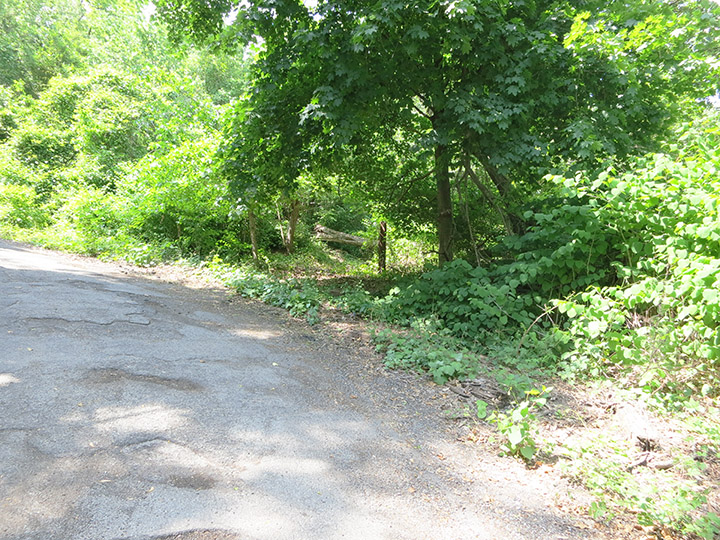
Current Entrance to the Trail
The current entrance to the trail is at the intersection of Hodge and Mackey Streets. Unfortunately, this entrance is frequently blocked by cars parking in this location. In time, the trail entrance should be moved to the level section of Hodge Street, leaving this trail location for cars to turn around in. A chain should be put across this entrance to prevent cars from pulling onto the trail itself, and this trail entrance should be only used for maintenance and pedestrians.

Curved End of the Trail
A more direct path is being cleared from the foot of Hodge Street directly onto the trail itself. This route will provide a connection for pedestrians and cyclists traveling both up and down the Bates Street trail. Moving the trail entrance to this location will also eliminate any possible intersection of cyclists and motorists using the Mackey Street turnaround. This image shows the density of brush on the overgrown hillside prior to being cleared. Note the large fallen tree that will need to be cleared to open this path. The intersection of Mackey and Hodge Streets is up and to the left.
View Down Hodge Street
Compared to Bates Street, Hodge Street makes an excellent bicycle route, being almost flat and having low traffic. The most important feature of Hodge Street is that it allows travelers to pass under I-376, avoiding the need to cross this high speed exit ramp onto Bates Street. In time, Hodge Street should be put back onto the city’s street paving schedule. Currently, the road surface consists of fifty years of asphalt patches over only a shallow road bed.
