Bates Street Bike Connector
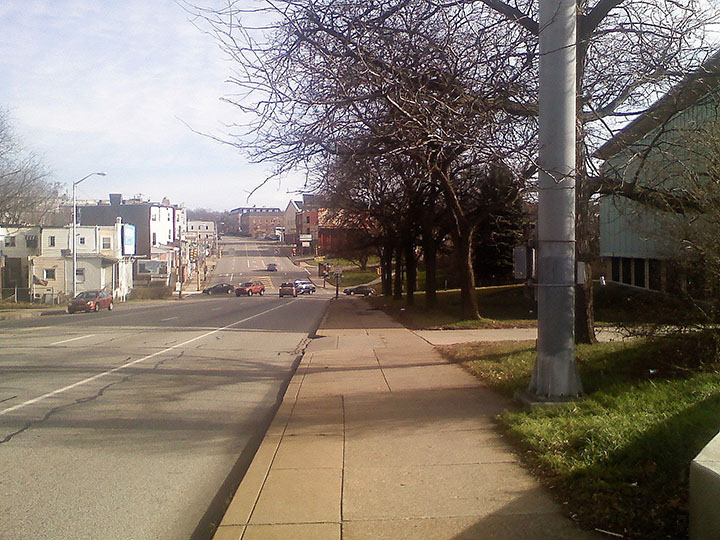
Long View Of Bates
Bates Street in South Oakland is located in a natural gully leading down off of the Oakland plateau. Being a natural drainage point of the plateau, it provides one of the lowest elevations down to the level of the river. Even though it is one of the best access points off of the plateau, it is still dangerously narrow for automotive transport, and even worse for bicycle and foot traffic.
As shown here with cars exiting and entering Boulevard of the Allies, Bates Street is only marginally accessible by bicycle from the west side where this picture was taken, and even less accessible from the east side. Worse, the entrance ramp to Interstate 376 East is located at the foot of Bates Street, and there is heavy traffic from the hospitals and universities.
One proposal is to slow traffic through this intersection with the use of a median strip where possible. Ideally, the Boulevard of the Allies should be widened at this point to move the dedicated right hand turn lane onto Bates out of the main line of traffic and allowing the center turn lane to continue up this stretch to allow this median strip to be built. Also ideally, a bicycle path could be built behind the row of trees pictured on the City-owned land in front of the electrical switching station.
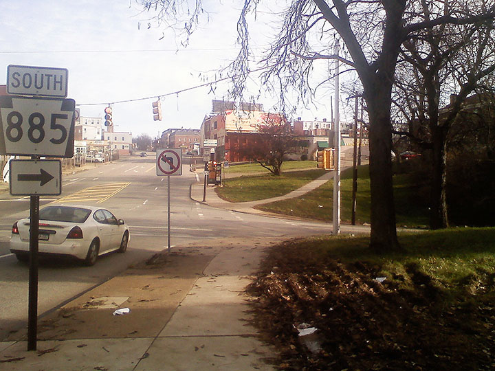
Corner of Bates
The entrance to Bates Street is narrow for cars, and the crossing of both Bates Street, pictured to the right, and the Boulevard of the Allies, pictured to the left, are intimidating for pedestrians and cyclists. These crossings have poorly marked crosswalks, no crossing signs, and non-ADA compliant curb cuts. Even crossing with the light, pedestrians need to be careful of the cars that turn turn right onto Bates Street. Also note that the sidewalk ends on the far side of the street. There is no sidewalk down the east side of Bates Street.
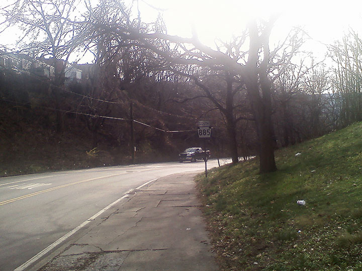
Top Corner on Bates
This view from the top of Bates Street shows the narrow and broken sidewalk and the first blind corner on this street. Although Bates Street is listed as a bicycle route clearly this sidewalk is not a compliant bicycle path. Ideally, this sidewalk on the west side of Bates Street could be widened and formalized as a bicycle path by replanting the trees further up the embankment. Also note the steep slope of the east side of Bates Street.
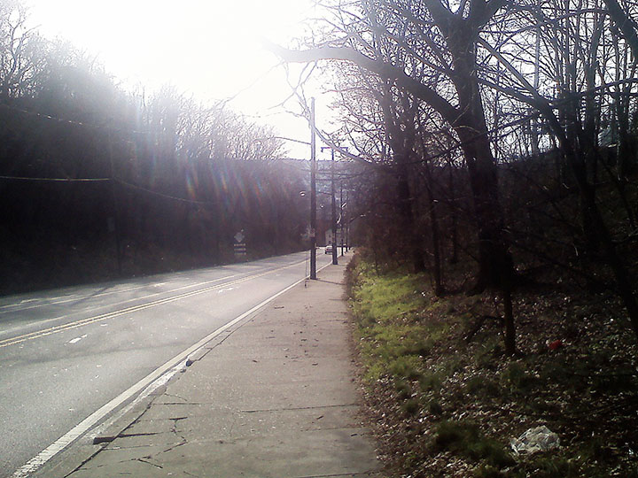
Top of Bates
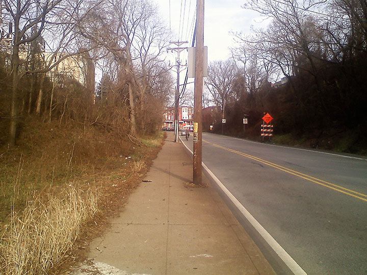
Rounding the first corner on Bates Street, it becomes even more clear how narrow and dangerous this sidewalk is. As shown here, telephone poles make this sidewalk even more narrow to negotiate by bicycle, leading many cyclists to ride in the street, despite the high speed traffic. Note in this picture that the City-owned land to the right of the sidewalk could be used to build a full width bicycle path in this location.
Top of Bates Street Looking Up
Shown here is one intrepid cyclist riding in the lane of traffic rather than riding on this narrow sidewalk shown, or on the completely impassable sidewalk below. Shown to the left in this picture is the start of an inlet to a historic walking path that connected Bates Street with Craft Avenue before Craft Avenue was filled and made inaccessible to pedestrian access.
Proposed Bates Street Bike Route
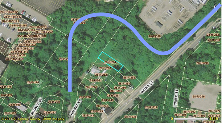
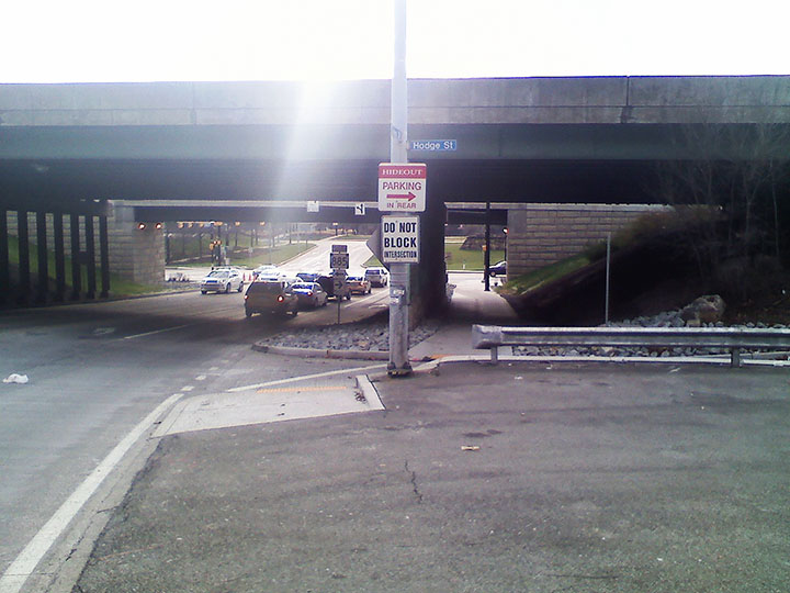
Although Craft Avenue is now made inaccessible to the Bates Street foot path by a man-made cliff about 70 vertical foot in height, this path can be reopened as a useful path with a slow grade to be able to access Hodge Street, as seen HERE. Hodge Street is a low traffic, shallow grade street that runs parallel to Bates Street and has the advantage of avoiding the nearly impassable sidewalk on the lower section of Bates Street. It also provides an overpass that eliminates the need for pedestrians and cyclists to cross the dangerous Route 376 exit ramp.
View up Bates
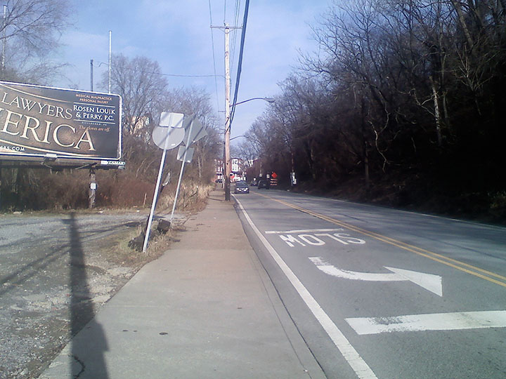
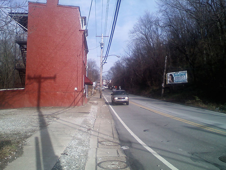
Below is the proposed turn out path from Bates Street, shown as a wooded area to the left before the billboard. After this billboard, there are driveways a turn-around that make the sidewalk less safe for cyclists and pedestrians. To make Bates Street even less pedestrian friendly, it has been proposed that the roadway be widened to increase the speed of the traffic. If Bates Street were to be increased in width in the direction of the power facility, it would require the demolition of several buildings below. It is likely that an increased cut into the rocky embankment to the right would be needed to implement this plan.
Stone Ledge on Bates
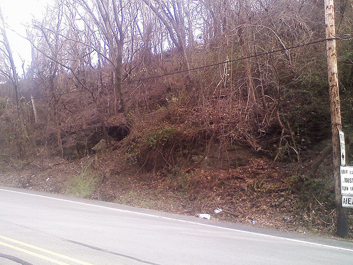
In this image, one can see the stone ledge that supports this Bates Street slope. It is likely due to this stone ledge that this slope has not shifted, protecting the homes on Juliet and Romeo Streets above.
Long View up Bates
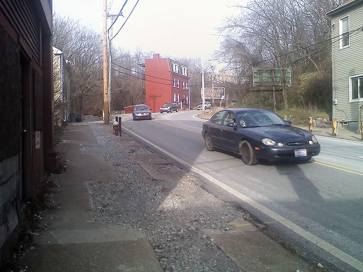
This image shows a longer view up Bates Street, and the proximity of some buildings to the roadway. Clearly there is no way to have an increased width path or roadway while these buildings are in this location. Worse, when water lines were replaced on Bates Street a year ago, the sidewalk was broken up and never repaired.
Up Around Lower Curve
Just above the fire hydrant pictured, there is a steel guard rail that protects the yellow house to the left from motorists who fail to negotiate this curve. According to the roadway maintenance people, this guardrail needs repair about once a year from multiple impacts. Here again, see the sidewalk in need of repair, making it unnavigable by bicycle, and almost unnavigable by foot.
Highway Ramp on Bates
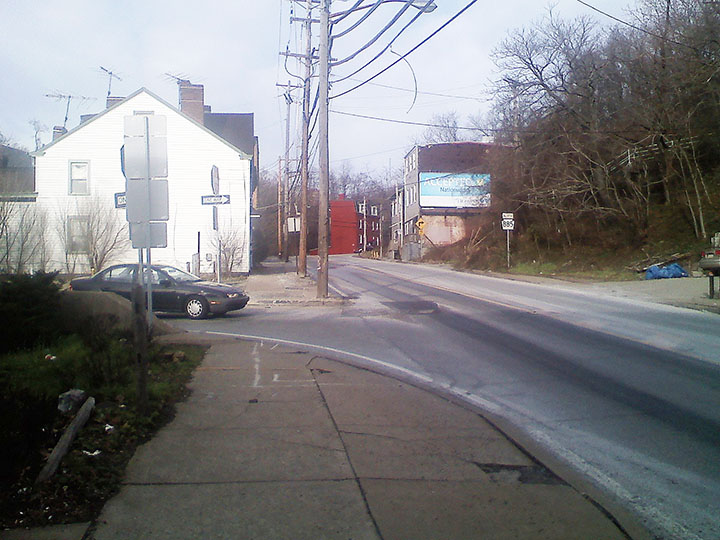
Slightly lower down on Bates Street is the exit ramp from Route 376. There is no crosswalk or even stop line for motorists exiting onto Bates Street. This crosswalk requires cyclists to lift their bicycles off of the sidewalk and onto two curbs, and it is particularly dangerous if one is traveling up the hill, as motorists are not looking for traffic coming from this direction.
Last Block of Bates
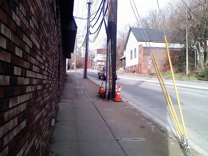
Below the highway entrance ramp, there is a commercial business with doors that swing outward onto the sidewalk. Between these doors, the telephone poles, and the narrow walkway between the high speed traffic and the brick wall, it is not surprising that many cyclists just choose to ride in the street.
Bottom of Bates
Finally, at the bottom of Bates Street, cyclists are offered a narrow and awkward crosswalk across the bottom of Hodge Street to a sidewalk that travels a quarter mile west on Second Avenue to a plywood ramp onto the Eliza Furnace Trail. In all, the short trip down Bates Street is dangerous for many reasons and would be much safer if riders could be diverted onto Hodge Street. Click HERE to view the more detailed analysis of Hodge Street.
