Brady Street Path
If you want to get to Downtown Pittsburgh from in South Oakland, the most promising proposed bicycle route is the Brady Street path, which connects Forbes Avenue to the Eliza Furnace Trail. Bellow are twenty-four images and maps detailing this half mile route.
You can also see and hear an Audio Version Of This Tour.
There is also a version of the tour Optimized For Mobile Devices.
Bike Path Viewed from Forbes Avenue
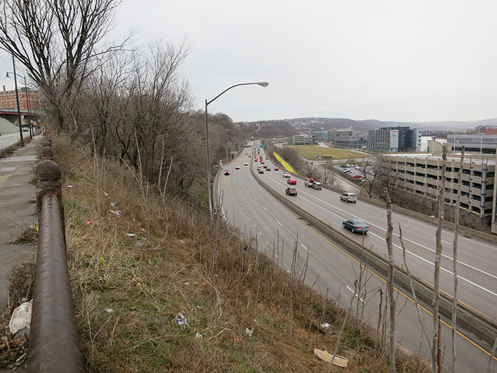
Looking from this vantage point on Forbes Avenue, just east of the Birmingham Bridge, one can understand the difficulty of reaching the Eliza Furnace Trail from South Oakland. Without the Brady Street path, a cyclist would need to cross six lanes of Interstate 376 in order to reach the Eliza Furnace Trail, highlighted here in YELLOW .
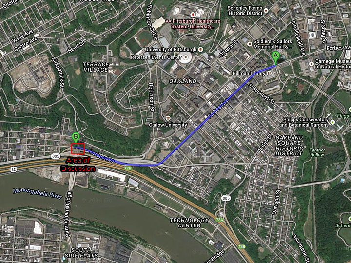
Since crossing the highway cannot be done safely, we propose a quarter mile loop under the highway starting here on Forbes Avenue, making a left on Brady Street, and making another left on Second Avenue to connect with the Eliza Furnace Trail.
Across from the highlighted portion of the Trail, one can also see the highway turnout on the north side of Interstate 376 that indicates the position of the Rock Alley tunnel.
Map of Proposed Route from Forbes Avenue to the Eliza Furnace Trail
Although following Brady Street is the most promising route from Forbes Avenue down to the Eliza Furnace Trail, there are several parts of this path that need to be improved for this to be a safe and useful bicycle connector.
View Up Forbes Avenue to Oakland Business District
Looking east up Forbes Avenue, one can see the wide and clear sidewalk up to Craft Avenue at the traffic light at the top of the hill. Beyond Craft Avenue is the Oakland Business District, punctuated by the Cathedral of Learning on the Schenley Park plaza, shown here in the distance.
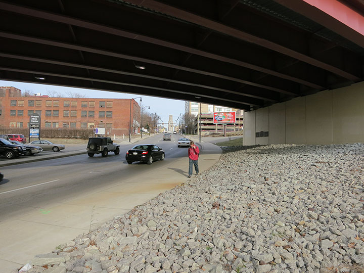
View Down Forbes Avenue
Traveling west on Forbes Avenue, the wide and clear sidewalk continues, connecting to Brady Street about 1200 feet below. This sidewalk has been recently installed with a modern cement barrier and a new metal fence. Unfortunately, this sidewalk is not wide enough to fall under the City of Pittsburgh’s specification for a bicycle path. It would be possible to widen this path by extending the sidewalk over the Rock Alley slope, although the width of the sidewalk is the least significant of the issues that need to be addressed for this path to be complete.
The wooded area on the left of this picture is the Rock Alley slope. The location of the crosswalk in this picture is approximately in the historic location of Maurice Street, which went down the slope and connected with the Rock Alley tunnel that passes under Interstate 376.
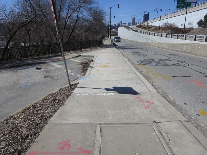
Pedestrian Crossing at Forbes Avenue
In order for Oakland residents to reach Brady Street from Forbes Avenue, they must cross the Interstate 376 exit ramp. Cars typically exit from Interstate 376 at over 50 miles per hour, and the drivers’ line of sight to this pedestrian crossing is too short to slow down from this speed.
Even though this is the only crossing available, it is not an official City of Pittsburgh pedestrian crosswalk. To make this a safe crosswalk, the speed of cars exiting Interstate 376 will need to be reduced. There are several well-understood solutions that should be implemented to reduce the speed of motorists, including warning signs, crosswalk markings, and most importantly, rumble strips. Having rumble strips installed will require community support, as there may be a noise issue for nearby homes. A noise study may be needed to further assess this solution.
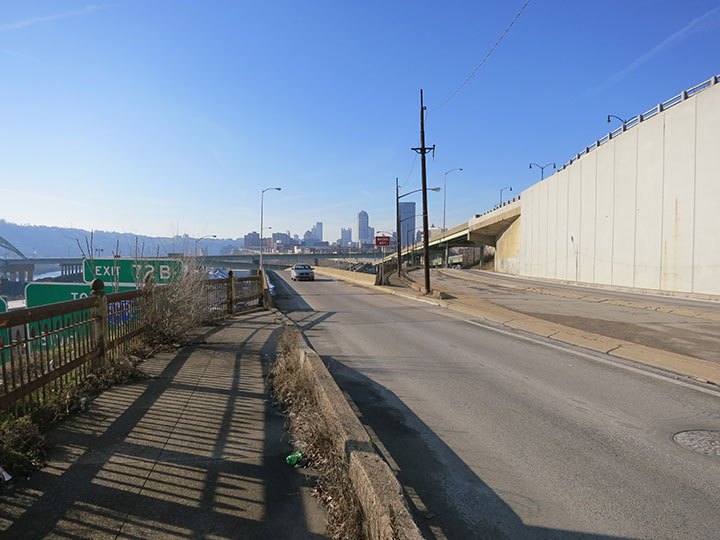
Proposed Improved Crossing on Forbes Avenue
One way to improve the safety of this Forbes Avenue crossing may be to increase the line of sight of the motorists coming off of the Interstate 376 ramp. From this vantage point further up on Forbes Avenue, one can see the potential of placing the pedestrian crossing further away from the ramp and having pedestrians walk in the median. A study would need to be done to evaluate the relative safety of this solution.
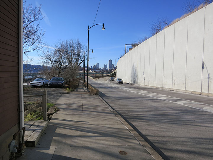
Unused Pedestrian Lane on Forbes Avenue
Once a pedestrian crosses the Interstate 376 exit ramp, there is a safe and clear passage down Forbes Avenue along the sidewalk. This sidewalk is wide enough for pedestrians, although it is uncomfortably narrow for cyclists. A better choice for cyclists is to ride on the unused lane of Forbes Avenue.
This lane is technically a route for emergency vehicles traveling east on Forbes Avenue, although it is almost never used. This lane could possibly be designated as a bicycle path with the appropriate warning signs. If this reclassification is not possible, there is enough space to narrow the median to the travel lane and widen the sidewalk. Further down on Forbes Avenue, there is enough land for a bicycle path on the grassy median to the left of this emergency lane.
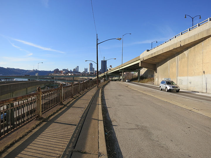
Curb Cut Needed on Forbes Avenue
At the bottom of the unused lane on Forbes Avenue, the street merges with the eastbound travel lane. At this juncture, cyclists either need to lift their bicycles onto the curb and ride across the cobblestone area under the bridge, or to ride between the white pilons and travel against traffic on Forbes Avenue.
There should be a curb cut installed at the bottom of this lane to allow cyclists to bike up onto this paved area and not into traffic.
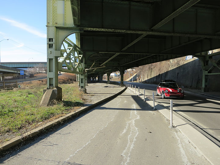
Paving Needed Over Existing Cobblestone
Ideally, when this curb cut is made, a bicycle lane could be paved over the existing cobblestones.
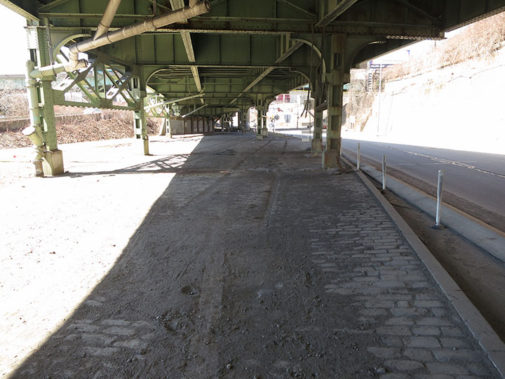
Missing Crosswalk on Forbes Avenue
At the bottom of the cobblestone area, the lower exit ramp for the Birmingham Bridge intersects Forbes Avenue. If cyclists have ridden on the pedestrian path, there are several problems they face:
- Although required for ADA compliance, there are no curb cuts on either the east or west side of this exit ramp.
- Although there is a stop line, there is no pedestrian crosswalk painted or room for it to be placed. To fix problem, the stop line should be moved back and a crosswalk should be painted in this location.
- The logical location for this crosswalk connects to an unpaved area under the bridge. The sidewalk under the Birmingham Bridge should be widened to include this unpaved strip under the bridge.
- Although there are pedestrian crossing indicators here, they are aimed in the wrong direction so that they cannot be seen from the path. These pedestrian crossing signs need to be redirected so that pedestrians can see them.
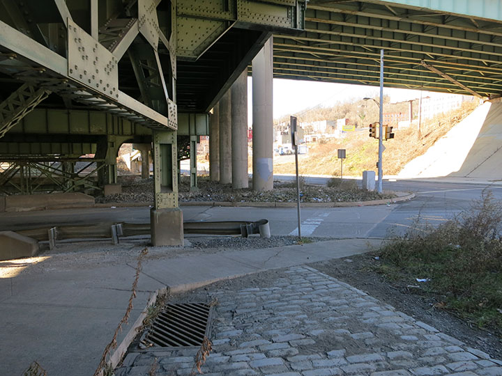
Space for a Bike Path along Forbes Avenue
As shown here under the Birmingham Bridge, there is enough unobstructed land for the sidewalk along Forbes Avenue to be widened to the specification ten foot width of a bicycle path. A path in this location would also align with the locations of the crosswalks across both the entry and the exit to the Birmingham Bridge.
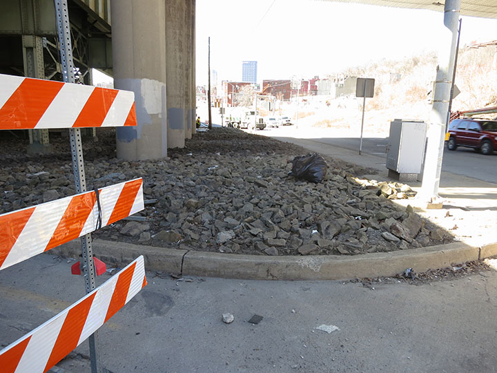
Misaligned Sidewalk at the Birmingham Bridge Entrance
Looking across the Forbes Avenue entrance ramp to the Birmingham Bridge, one can see an almost identical set of problems as along the exit ramp:
- Although required by ADA compliance, there is no curb cut on either the east or west side of this entrance ramp.
- Although a pedestrian crosswalk is painted here, it does not line up with the sidewalk. As with the exit ramp, this crosswalk is in the right location to line up with the new sidewalk across the brush-covered area pictured above.
- As with the crossing at the exit ramp, the pedestrian crossing indicators that are installed do not line up with the sidewalk. When the sidewalk is moved, these crossing indicators should be moved accordingly.
- Also pictured is the entrance to the bike path onto the Birmingham Bridge. It is good to have the bicycle lanes painted on the bridge, but without the needed improvements made to the sidewalks and curbs, there is no way for bicyclists to safely access these routes.
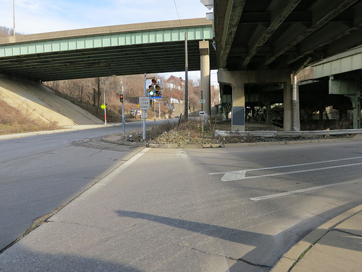
Proposal Sent to Oakland Transportation Management Association (OTMA)
In March of 2015, the previous six images were sent to OTMA as suggestions for upgrades to the route connecting South Oakland with the renovation of the bike path taking place on the Birmingham Bridge at that time. These six images and the accompanying brief explanatory paragraphs were sent to Mavis Rainey at OTMA as a separate PDF, which may be viewed here: OTMA 3_20_15
Misaligned Sidewalk on Forbes Avenue
Viewing west on Forbes Avenue across the entrance to the Birmingham Bridge one can see the logic of moving the sidewalk to line up with the existing crosswalks and existing sidewalk on Forbes. Note that in these cases the pedestrian signs are in the correct locations.
Beyond the Birmingham Bridge entrance one can see the unmarked entrance to Brady Street shown with cars exiting here. Brady Street itself is a one block long curving street that passes under the Birmingham Bridge and is the only connection between Forbes Avenue and Second Avenue for more than a mile east or west on Forbes Avenue. Without this path, the next best access to the Trail is a makeshift wooden ramp off of Second Avenue at the foot of Bates Street a mile east, or a trip to Grant Street more than a mile and a half west.
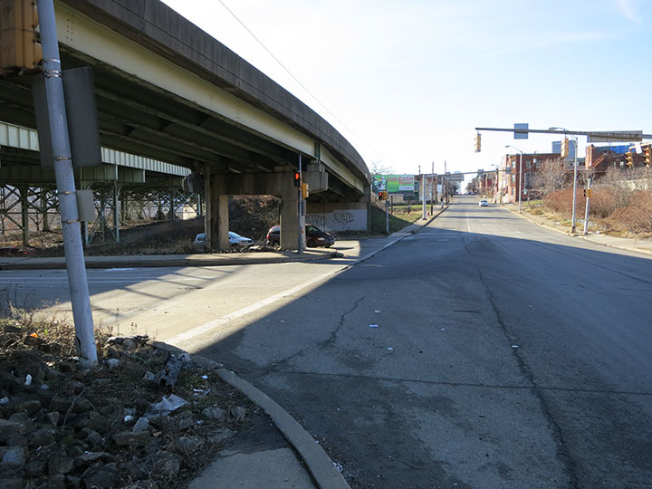
Missing Curb Cut at the Top of Brady Street
There are no curb cuts onto the Birmingham Bridge sidewalk or onto the sidewalk on Brady Street. Also note that there is no sidewalk along the west side of Brady Street. Referring to the relocation plans drawn in 1951, there were sidewalks indicated on both sides of the street, although for reasons that will be shown, no sidewalk can be built on the west side of Brady Street.
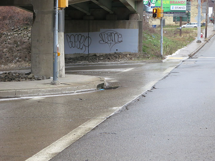
Sidewalk at the Top of Brady Street
The sidewalk at the top of Brady Street is narrow, broken, and overgrown. However, there is enough room for this sidewalk along the east side of Brady Street to be replaced and widened to ten feet, as required to make this a usable bike path.
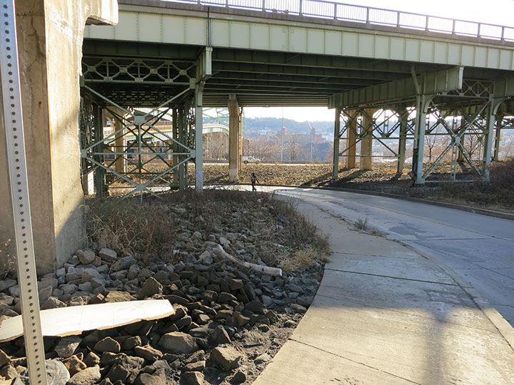
End of Sidewalk on Brady Street
Unfortunately, the sidewalk on the east side of Brady Street stops abruptly halfway down the street at a bridge abutment, forcing pedestrians and cyclists to walk the remaining distance to Second Avenue in high speed traffic. The 1951 plans for the relocation of Brady Street did not clearly indicate the location of the sidewalk, and this issue was never resolved. Apparently, there was insufficient planning to have the sidewalk built in the clear space behind the bridge abutments. Ironically, this redesign will place the sidewalk for Brady Street in the location that it was before Brady Street itself was relocated.
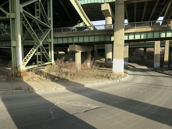
Land for Sidewalk on the East Side of Brady Street
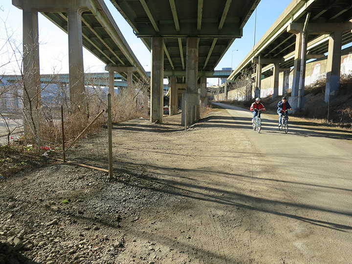
Although a sidewalk down Brady Street could be built by extending the bottom of the existing sidewalk, a bicycle path would be better built by curving the sidewalk earlier underneath the bridge supports. As shown below, there is enough land for a ten foot wide path. Following this route, the bridge would be more than nine feet above the path.
What is not clear from the 1951 drawings for the relocation of Brady Street is if the land under these bridge abutments is property of the Pennsylvania Department of Transportation (PennDOT), or the City of Pittsburgh. Who controls this land is an issue that will need to be resolved for this path to be built.
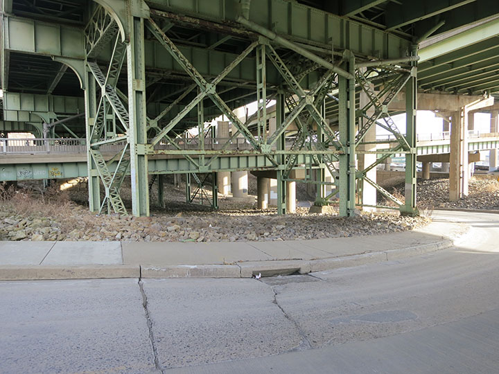
Land for Sidewalk on the East Side of Brady Street #2
There is enough land for a ten foot wide bicycle path to curve to the right of the round bridge support in the middle of this picture. This route keeps cyclists safely above the Brady Street roadway.
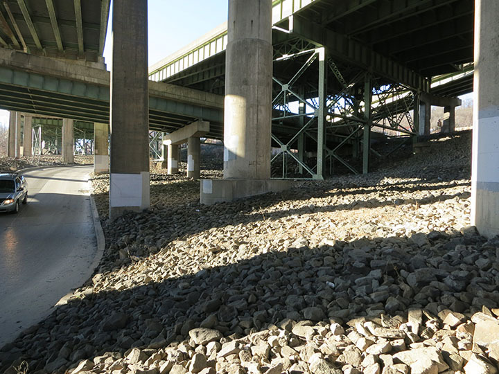
Bottom of Brady Street
At the lowest bridge abutment, the bicycle path would need to narrow to nine and half feet. The rest of the Brady Street bike path, however, could maintain its full ten foot width.
Also shown in this image is one of three manhole covers that were at the elevation of Brady Street before its relocation. A bicycle path in this location could not be lower than the elevation of these manhole covers.
Note the location of the Eliza Furnace Trail, shown here passing over Brady Street with fences on either side. Also note that the bridge abutments prevent a sidewalk from being built on the opposite side of the street.
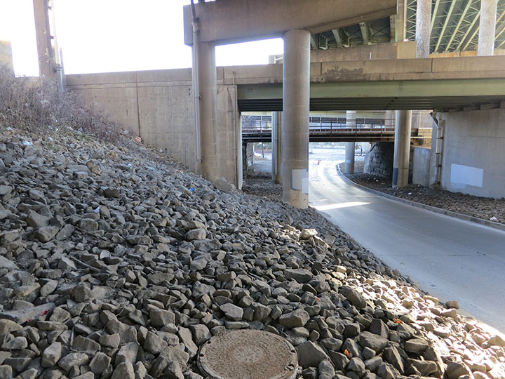
Foot of Brady Street onto Second Avenue
At the corner of Brady Street and Second Avenue is a parking lot owned by PennDOT, shown here to the left. The proposal is to move the Jersey barrier shown on the left and use this as the location of the bicycle path.
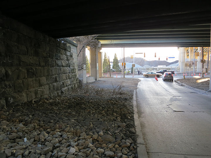
Long View up Brady Street
When the bicycle path described on this page has been built, Brady Street will serve as an excellent connection between Forbes Avenue and Second Avenues for cyclists traveling from South Oakland to the Eliza Furnace Trail. Installing the needed 500 feet of bicycle path on Brady Street will help move Pittsburgh above its position as only the 28th most bikeable city in the U.S.
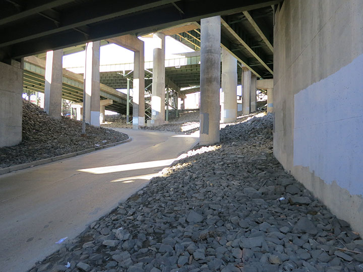
Envisioned Location of Brady Street Sidewalk
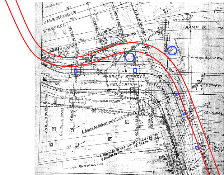
Referencing the original 1951 Brady Street relocation map, the location of the bridge supports are clearly indicated. On this plan, the location of the sidewalk was never resolved, shown here ending at a bridge support as it was built. As seen in this plan and in the above images, there is space between the bridge abutments for a ten foot wide bicycle path to be built. In this drawing, the critical bridge supports are highlighted in blue, and the edges of the proposed path are indicated in red.
View across the PennDOT Parking Lot
As shown in this picture, there is enough room to pave a bicycle path along the back of this PennDOT parking lot. One concern raised by a PennDot representative is that if this lot were paved, drivers might use it as a park-and-ride to the bike trail. One solution would be to build a fence to partition the paved trail from the remainder of this lot to prevent drivers from parking on the bicycle trail itself.
It has been proposed that a lease agreement would need to be drawn up between the City of Pittsburgh and PennDOT for the use of this land as a bicycle path. Visible at the back of this parking lot is a ramp leading up to the Eliza Furnace Trail.
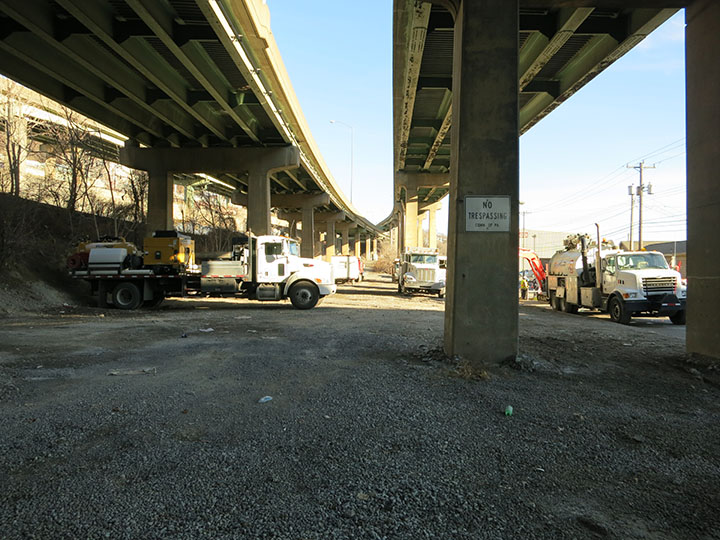
Entrance onto the Eliza Furnace Trail from the PennDOT Parking Lot
This image shows the entrance onto the Eliza Furnace Trail from the PennDOT parking lot. This ramp is currently being used for service vehicles to enter the Eliza Furnace Trail, as it was used to maintain the rail beds before this path was converted to a bicycle trail.
